Abstract
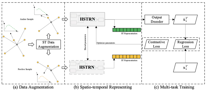
To monitor the running status of modern cities, various sensors deployed in cities generate geo-sensory data. Such data enable many intelligent applications such as pollution forecasting and traffic warning. The sensors of a specific type are very sparse in the city, leading to the coarse grain of geo-sensory data. To obtain fine-grained geo-sensory data and improve the service quality of applications, we need to infer geo-sensory data at unmonitored locations. However, it is challenging in two aspects: 1) rare and sparse labeled locations with sensors; 2) complex and dynamic spatio-temporal correlations. To overcome the above issues, we propose a novel method based on spatio-temporal contrastive learning for geo-sensory data inference (GSDI). The proposed method consists of two major parts, i.e., spatio-temporal data augmentations and a hybrid spatio-temporal representation network. We propose several spatio-temporal data augmentation methods to generate positive samples for learning robust representations via contrastive learning. We also propose a hybrid spatio-temporal representation network to efficiently learn spatio-temporal representations for geo-sensory data inference. Furthermore, experiments on the real-world dataset show the advantages of our proposed methods. Our method achieves state-of-the-art and has 18.42% and 15.88% improvements on MAE and RMSE, respectively.